Alta Via 1
 Difficulty:
★★★☆☆ Beauty:
★★★★★ My experience:
★★★★☆
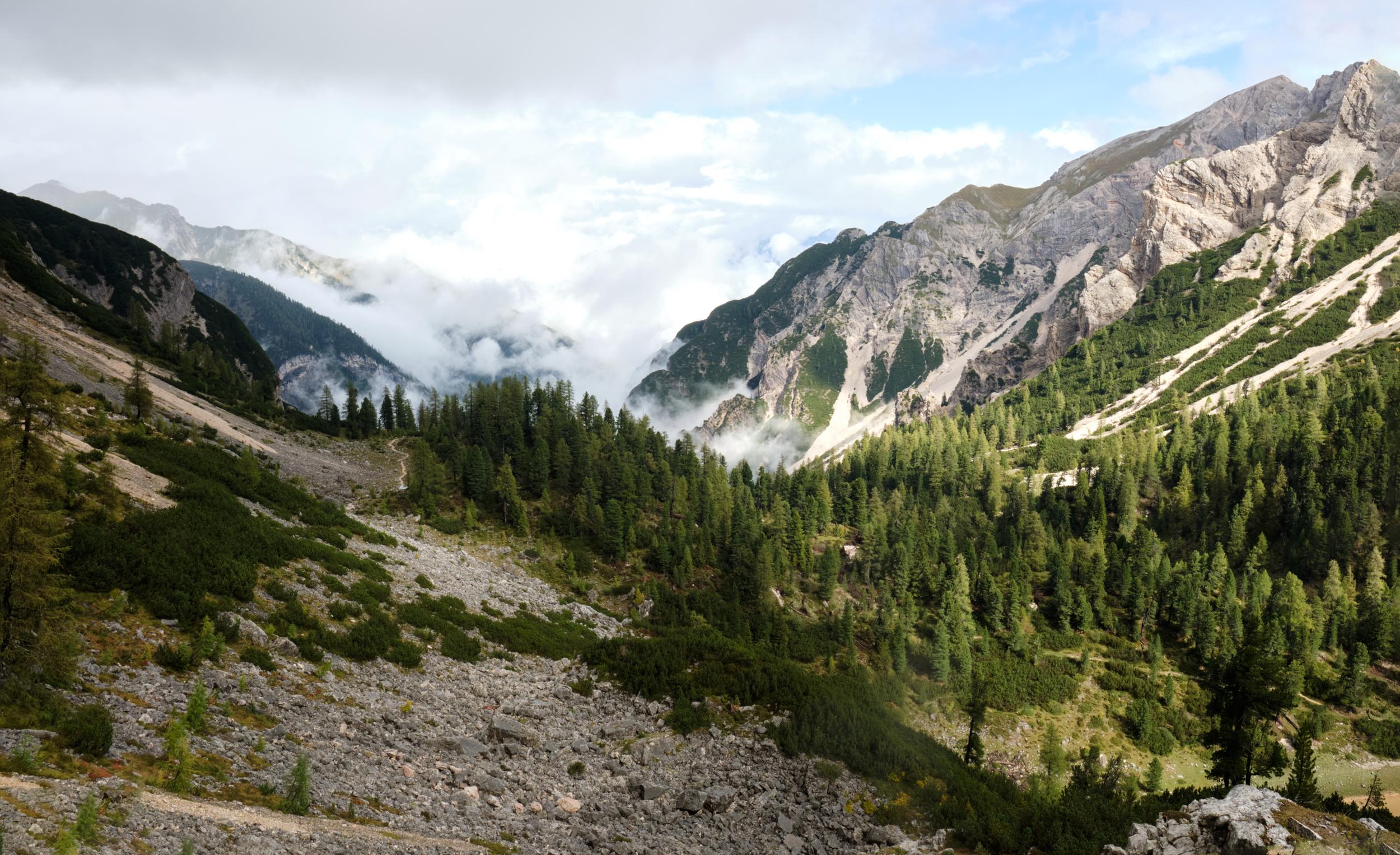
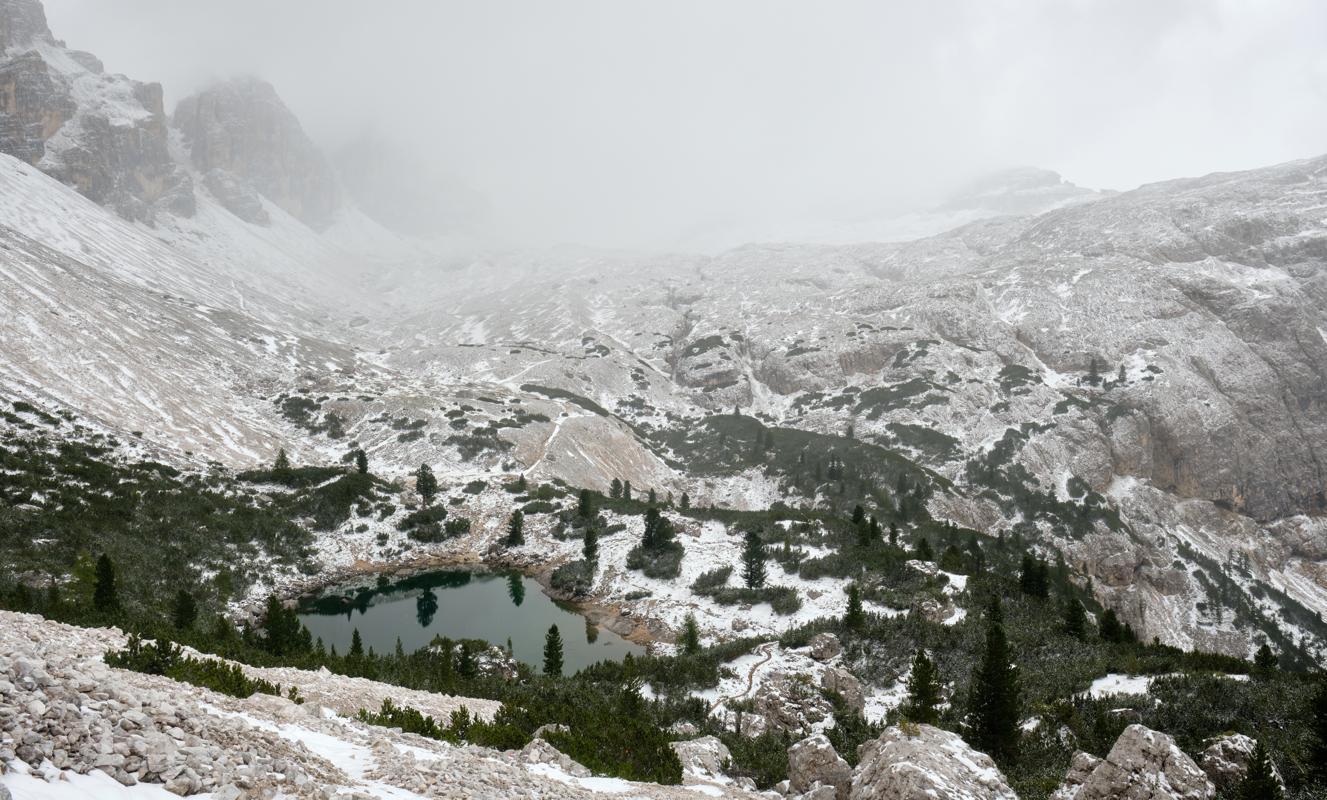
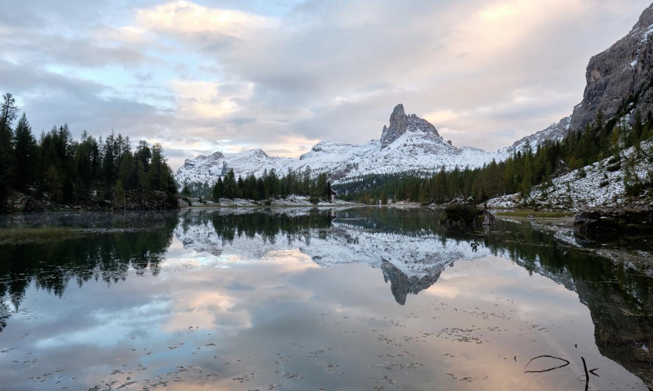
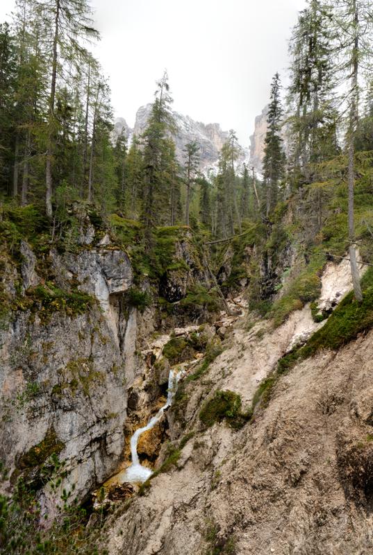
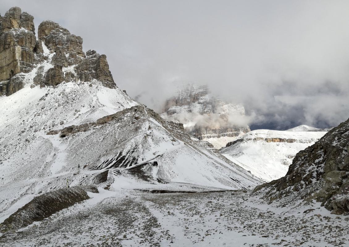
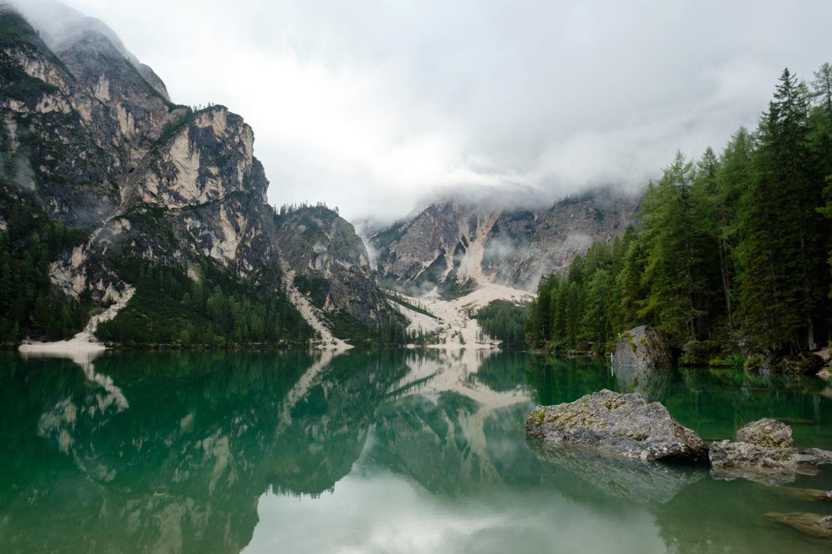
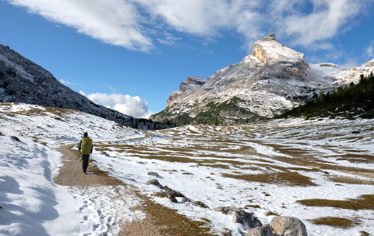
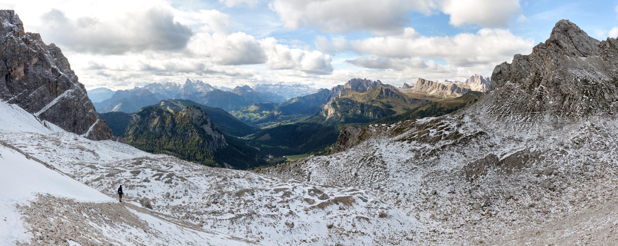
If you’re drawn to the dramatic limestone peaks of the Italian Dolomites, the Alta Via 1 offers a spectacular 120-kilometer trek that showcases the region’s finest scenery. Known as the “Classic High Route,” this well-marked trail runs from Lago di Braies in the north to Belluno in the south, passing through UNESCO World Heritage landscapes of towering spires, lush alpine meadows, and turquoise glacial lakes. Most of the route follows moderate mountain paths rather than extreme high passes, but daily elevation changes can still be challenging. While wild camping is generally prohibited, hikers can stay in a network of welcoming rifugi (mountain huts) and small inns, which also serve hearty meals. The best time to walk the Alta Via 1 is during the summer months, when the snow has melted from the higher sections but wildflowers still blanket the valleys. Did you know? The Dolomites were once part of a tropical coral reef over 200 million years ago, and their unique pale rock comes from ancient marine sediments.
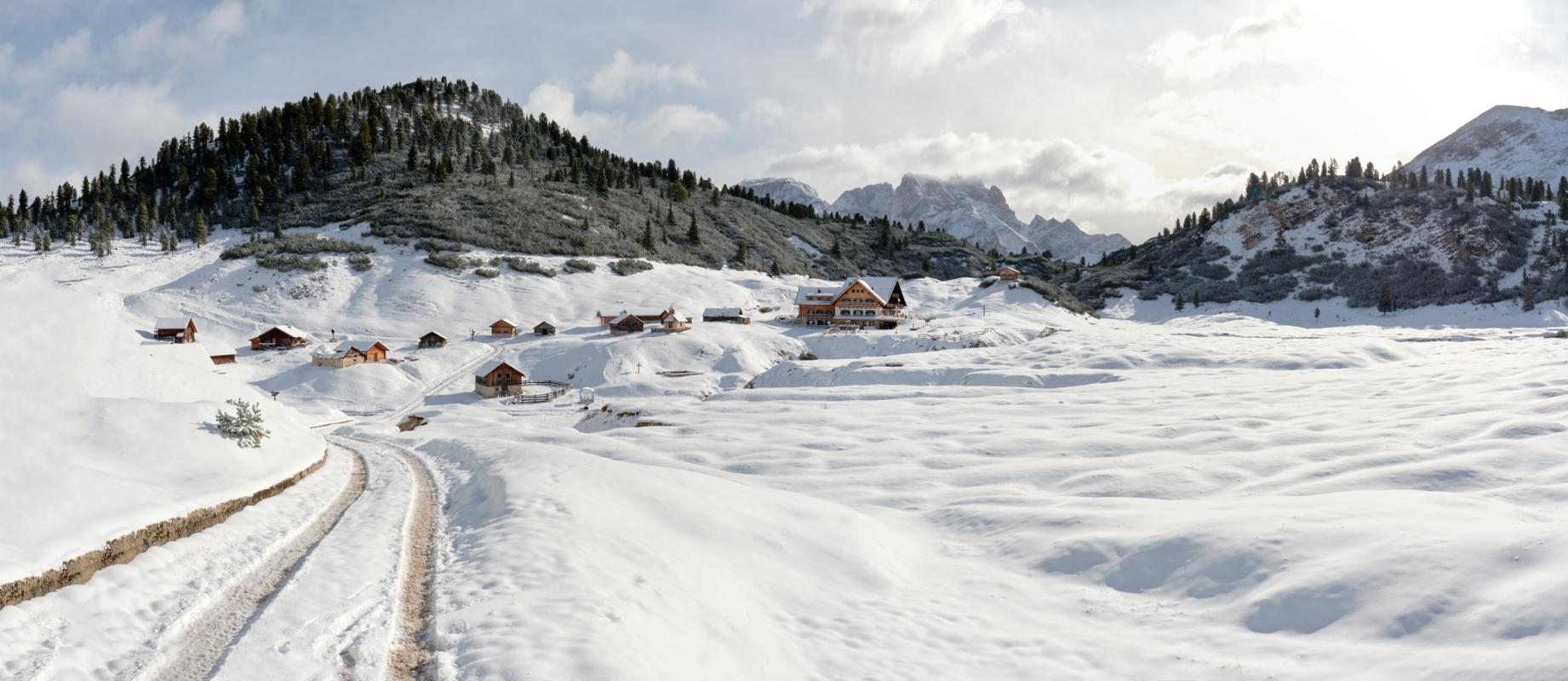
The Alta Via 1 was a mighty experience for me. While I was at the Alta Via 2 about a week earlier, hiking at 3000 meters in T-shirt, the weather shifted into snowfall on the first night we were there. This made the landscapes even more magical than they normally are. In combination with zero crowds (we were there at the end of September), even having an entire mountain hut for ourselves twice, it made the experience unforgettable. Depending on how you manage the stages, I also found it a rather leisury hike compared to some other alpine trails.
Some of my photos
Cortina d'Ampezzo
Weather data at 1211m
Historical data 1970-2000 from WorldClim2 (worldclim.org)
Access
Overnight
route my
route