2025
Surgery and unfavorable recovery process
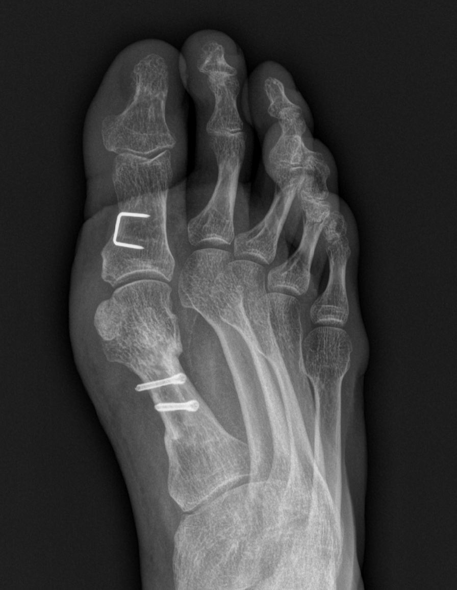
At the end of 2023, a seemingly innocent football incident led to a cascade of treatments, hypotheses, and a sequence of all of the most unlikely setbacks that one could foresee. Countless doctor, podologue, physiotherapist and osteopath visits later, I finally feel that I am rebuilding towards full recovery after more than two years of struggling, not being able to run or hike properly. Hence, the hunger to get back out there is stronger than ever, and I can't wait to share new adventures in the mountains once again.
2024
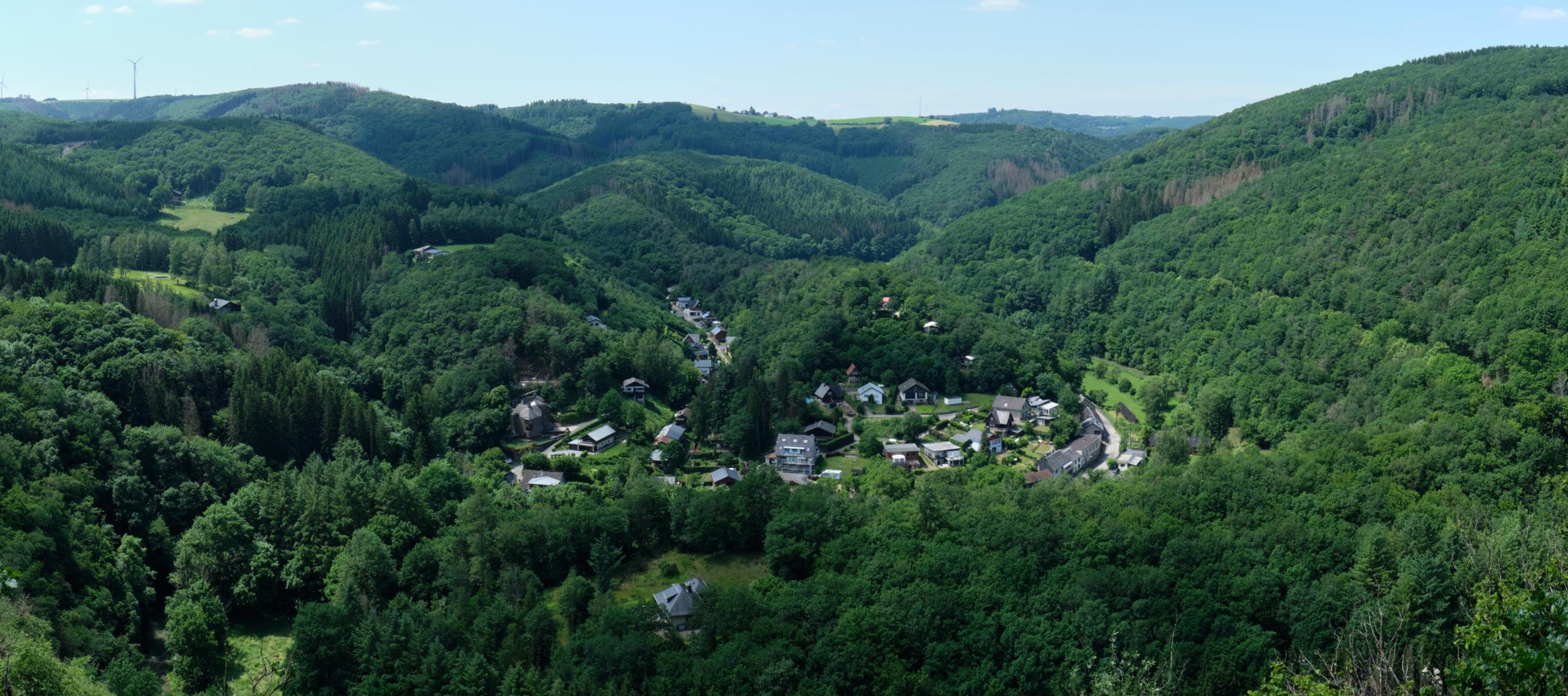
GR54 - Tour des Ecrins 
I walked about half of the GR54 on my own in 2023, before continuing to the South of France for cycling. I started in Bourg d'Oisans, started climbing Alpe d'Huez, and then changed my mind to continue south anyway (using a short bus ride to Venosc). There, I started hiking, camping every night on the route in multiple beautiful camping spots, both with and without facilities. The terrain made me sweat a lot, although that could also have been due to a heat wave that was going on, a whopping 37 degrees in the valleys!
I walked about half of the GR54 on my own in 2023, before continuing to the South of France for cycling. I started in Bourg d'Oisans, started climbing Alpe d'Huez, and then changed my mind to continue south anyway (using a short bus ride to Venosc). There, I started hiking, camping every night on the route in multiple beautiful camping spots, both with and without facilities. The terrain made me sweat a lot, although that could also have been due to a heat wave that was going on, a whopping 37 degrees in the valleys!
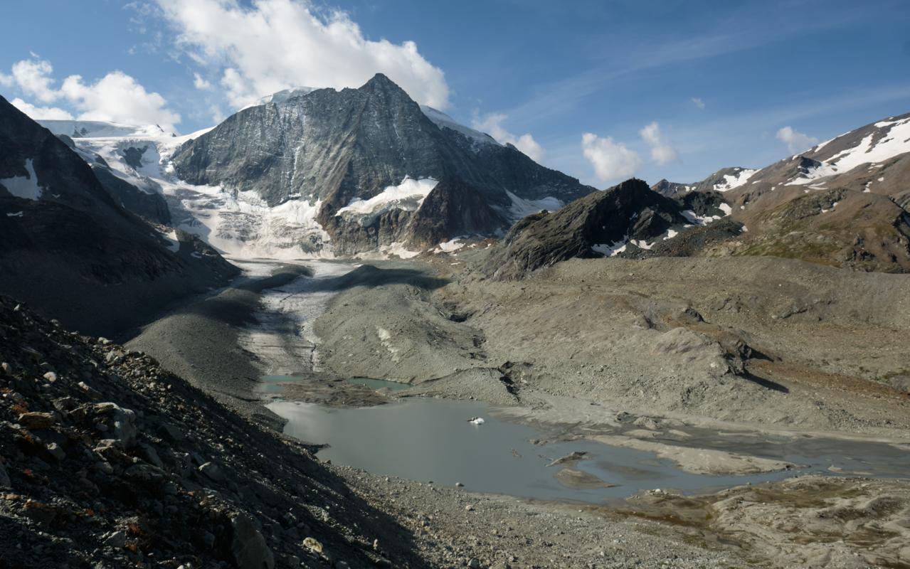
Glocknerrunde 
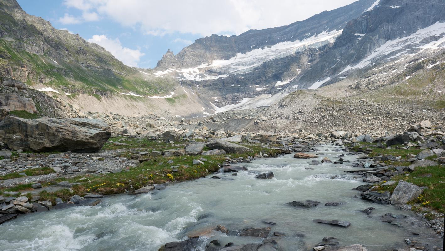
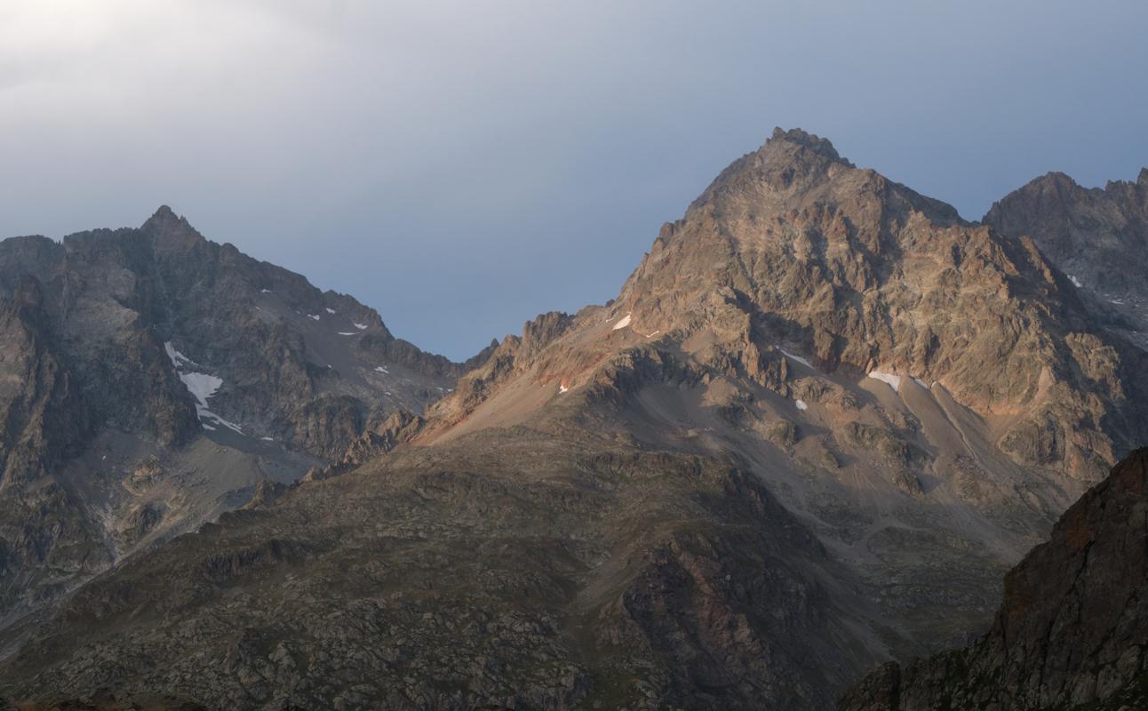
I found the Glockerrunde a very rewarding hike, with stunning views and lovely places to stay. The weather varied a lot, with the highest passes inaccessible for us due to high rainfall forecasts, many passes covered in snow, but also lots of sunshine. The snow especially made the hike more technical, but also more beautiful. Tourism is very present in the area, with very big mountain huts, sometimes accessible via lifts. All in all, an ideal trek for people who want a challenging hike on high altitude, but who also want to keep a certain level of comfort.
I found the Glockerrunde a very rewarding hike, with stunning views and lovely places to stay. The weather varied a lot, with the highest passes inaccessible for us due to high rainfall forecasts, many passes covered in snow, but also lots of sunshine. The snow especially made the hike more technical, but also more beautiful. Tourism is very present in the area, with very big mountain huts, sometimes accessible via lifts. All in all, an ideal trek for people who want a challenging hike on high altitude, but who also want to keep a certain level of comfort.
2023
Kungsleden 
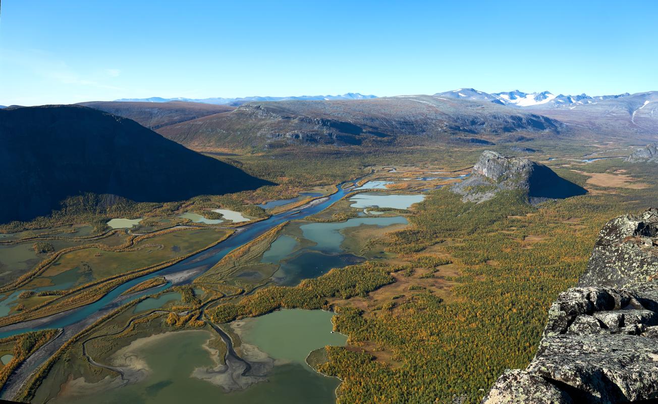
Ha, the Kungsleden. Without a shadow of doubt the most wonderful and craziest hiking experience I ever had, even if it included the full emotional rollercoaster from 'why am I doing this' to absolute bliss. It must be said that I was extremely lucky with the weather, only having to take out my rain jacket on day 23, and that there were no mosquitos and barely any other hikers so late in the season. Sheer desolation, endless views, and on top of that some cold but beautiful northern lights nights. One extra advise: I would strongly recommend hiking from south to north, as you will have the sun in your back, bigger chance of boats available (due to most people trekking N>S), and the most beautiful sections in the second half of the hike.
Ha, the Kungsleden. Without a shadow of doubt the most wonderful and craziest hiking experience I ever had, even if it included the full emotional rollercoaster from 'why am I doing this' to absolute bliss. It must be said that I was extremely lucky with the weather, only having to take out my rain jacket on day 23, and that there were no mosquitos and barely any other hikers so late in the season. Sheer desolation, endless views, and on top of that some cold but beautiful northern lights nights. One extra advise: I would strongly recommend hiking from south to north, as you will have the sun in your back, bigger chance of boats available (due to most people trekking N>S), and the most beautiful sections in the second half of the hike.
2022
Lee Trail 
I was personally less charmed by the Lee Trail than by the other part of the Escapardenne (Eislek Trail), but this was due to multiple factors, including some very poor weather. Guess I will have to come back to properly rate it here!
I was personally less charmed by the Lee Trail than by the other part of the Escapardenne (Eislek Trail), but this was due to multiple factors, including some very poor weather. Guess I will have to come back to properly rate it here!
Eislek Trail 
I was very charmed by this hike. We hiked the first four days of it around the time that Covid restrictions were starting to lift, and so we were able to drink a magic Orval at the Houffalize square in the Sun, on the day that bars opened up again, while there were thunderstorms in my hometown of Ghent. The thing that impressed me most on the trek was its versatility, with different types of landscapes crossed every day, and the very cozy places to stay (Clervaux, Moulin d'Asselborn, Houffalize).
I was very charmed by this hike. We hiked the first four days of it around the time that Covid restrictions were starting to lift, and so we were able to drink a magic Orval at the Houffalize square in the Sun, on the day that bars opened up again, while there were thunderstorms in my hometown of Ghent. The thing that impressed me most on the trek was its versatility, with different types of landscapes crossed every day, and the very cozy places to stay (Clervaux, Moulin d'Asselborn, Houffalize).
2021
Alta Via 1 
The Alta Via 1 was a mighty experience for me. While I was at the Alta Via 2 about a week earlier, hiking at 3000 meters in T-shirt, the weather shifted into snowfall on the first night we were there. This made the landscapes even more magical than they normally are. In combination with zero crowds (we were there at the end of September), even having an entire mountain hut for ourselves twice, it made the experience unforgettable. Depending on how you manage the stages, I also found it a rather leisury hike compared to some other alpine trails.
The Alta Via 1 was a mighty experience for me. While I was at the Alta Via 2 about a week earlier, hiking at 3000 meters in T-shirt, the weather shifted into snowfall on the first night we were there. This made the landscapes even more magical than they normally are. In combination with zero crowds (we were there at the end of September), even having an entire mountain hut for ourselves twice, it made the experience unforgettable. Depending on how you manage the stages, I also found it a rather leisury hike compared to some other alpine trails.
GR20 (North)
After a month in the Alps and a week in somewhat more comfortable circumstances, I went to Corsica to hike the north section of the GR20. Even though I was not fully ready to dive into the tent again mentally, I was immediately charmed by this island and the hike. It is truly wild, and there is some sense of togetherness with everyone who is hiking this challenging path. As I was well trained from previous hikes and with a lighter pack (I did not take any food or cooking utensils with me, always eating in the refuges), I found the trek very doable despite its reputation. I doubled one stage to hike 30 km in one day, and took a very nice alternative route on my final day. All in all, my favourite part of this trek was the degree of freedom it offers without giving up on the feeling of utter remoteness.
After a month in the Alps and a week in somewhat more comfortable circumstances, I went to Corsica to hike the north section of the GR20. Even though I was not fully ready to dive into the tent again mentally, I was immediately charmed by this island and the hike. It is truly wild, and there is some sense of togetherness with everyone who is hiking this challenging path. As I was well trained from previous hikes and with a lighter pack (I did not take any food or cooking utensils with me, always eating in the refuges), I found the trek very doable despite its reputation. I doubled one stage to hike 30 km in one day, and took a very nice alternative route on my final day. All in all, my favourite part of this trek was the degree of freedom it offers without giving up on the feeling of utter remoteness.
Walker's Haute Route 
After hiking the Tour du Mont Blanc in 2020, I immediately continued to Zermatt. At that time, I was used to my pack weight and hiking days, so despite the more demanding route, I found the Haute Route very manageable. Personally, I preferred the sceneries on the Haute Route over the TMB, and at the same time I barely ran into anyone else who was also doing this trail - I mainly met day hikers. The only downside was a lack of camping opportunities without putting up tent in protected areas.
After hiking the Tour du Mont Blanc in 2020, I immediately continued to Zermatt. At that time, I was used to my pack weight and hiking days, so despite the more demanding route, I found the Haute Route very manageable. Personally, I preferred the sceneries on the Haute Route over the TMB, and at the same time I barely ran into anyone else who was also doing this trail - I mainly met day hikers. The only downside was a lack of camping opportunities without putting up tent in protected areas.
Tour du Mont Blanc
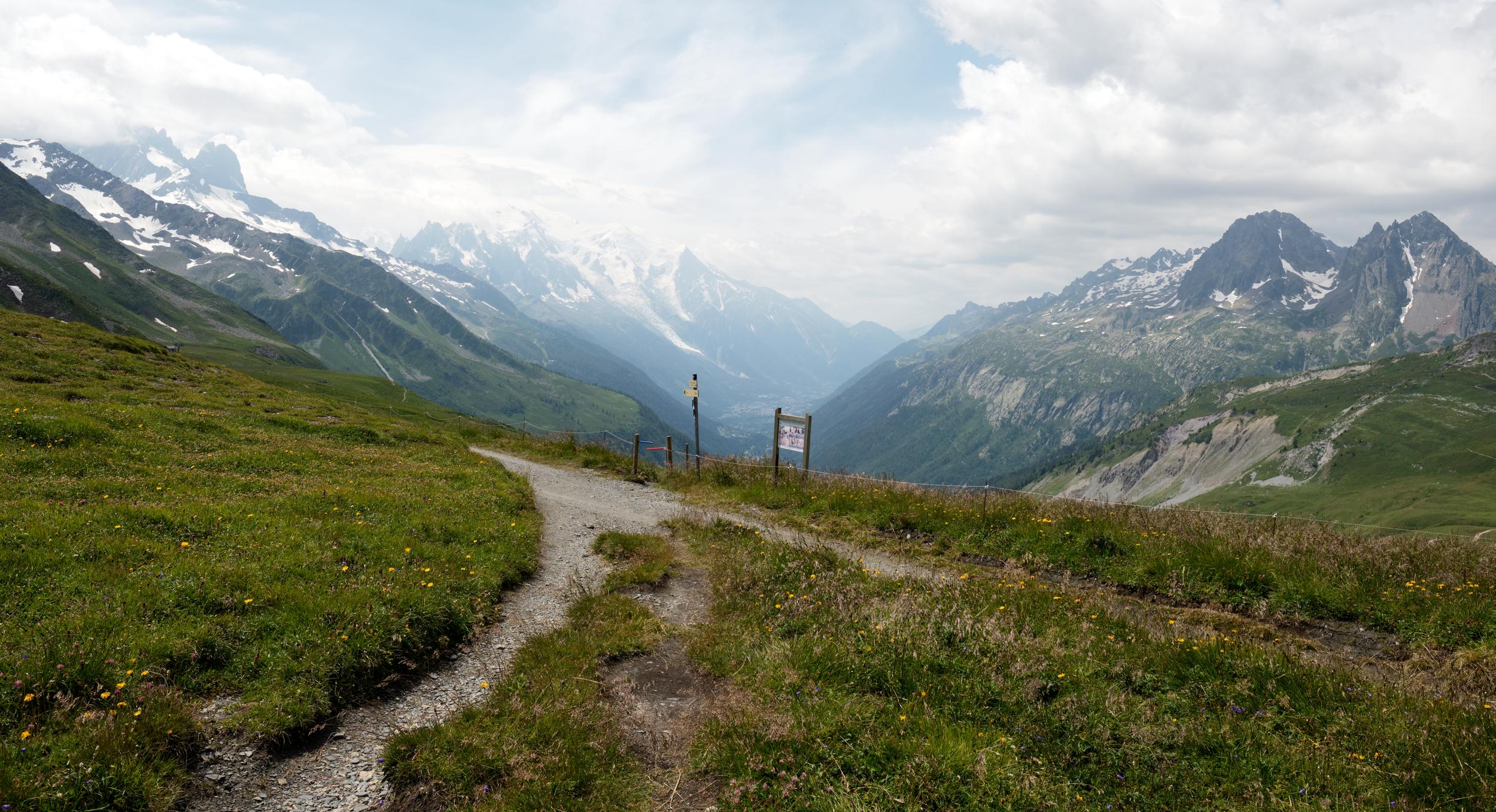
My experience on the TMB was fantastic. I went there in July 2020, as the first trip after getting my PhD and just after the worst part of the first Covid wave passed. As a result, there were not people out on the trail yet, so it was probably its calmest summer in a long while. The weather was very good, and I met a couple of Belgian groups and hikers, including someone who lives across my street and a former colleague. Bizarre! As I had the full summer to travel, I took some resting days and did some shorter days and alternative routes. I started in Champex-Lac, easily accessible by train (and a small bus drive up), which was the ideal starting point for me as it offered a nice warming up, and I anyway continued to Zermatt after finishing the loop. All in all, it was definitely not the hardest trek I ever did.
My experience on the TMB was fantastic. I went there in July 2020, as the first trip after getting my PhD and just after the worst part of the first Covid wave passed. As a result, there were not people out on the trail yet, so it was probably its calmest summer in a long while. The weather was very good, and I met a couple of Belgian groups and hikers, including someone who lives across my street and a former colleague. Bizarre! As I had the full summer to travel, I took some resting days and did some shorter days and alternative routes. I started in Champex-Lac, easily accessible by train (and a small bus drive up), which was the ideal starting point for me as it offered a nice warming up, and I anyway continued to Zermatt after finishing the loop. All in all, it was definitely not the hardest trek I ever did.
2020
Kumano Kodo - Kohechi 
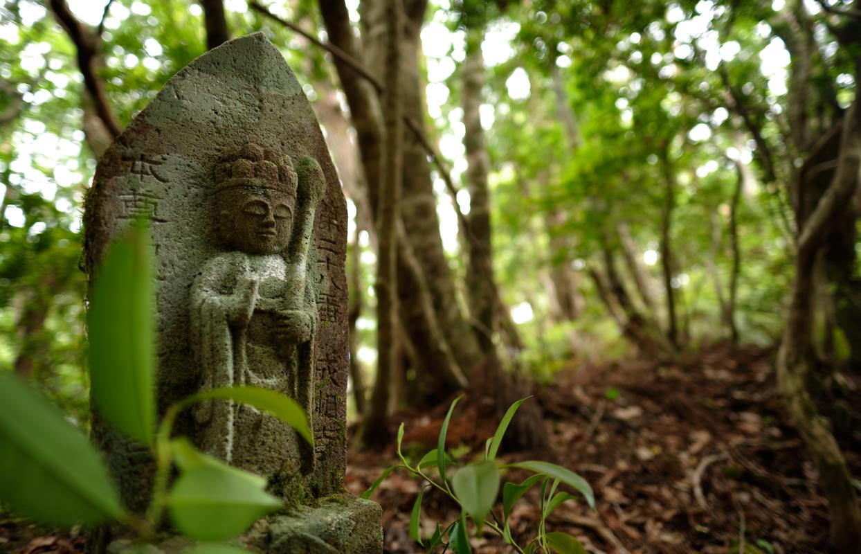
Hiking the Kohechi trail in Japan was an absolute blast. Instead of spectacular glaciers, high peaks and steep valleys, this hike gives you something different. I embraced the solitude on this trail (as I encountered one small group of Japanese hikers on my second day and that was it!), the holiness of this place, the respect with which people approach the monuments and nature, and the warm welcome by the completely non-English speaking hosts of my homestays. And not to forget, the natural Onsen hot tubs to regenerate the body after a long day of walking!
Hiking the Kohechi trail in Japan was an absolute blast. Instead of spectacular glaciers, high peaks and steep valleys, this hike gives you something different. I embraced the solitude on this trail (as I encountered one small group of Japanese hikers on my second day and that was it!), the holiness of this place, the respect with which people approach the monuments and nature, and the warm welcome by the completely non-English speaking hosts of my homestays. And not to forget, the natural Onsen hot tubs to regenerate the body after a long day of walking!
2019
2018
Mount Kinabalu 
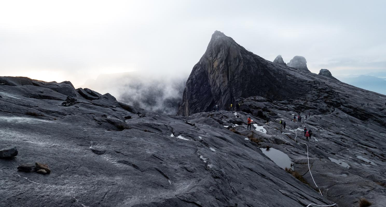
On my holiday on Borneo, I visited the rainforest, got my PADI diving license, and I wanted to do the most significant hike on the island - the ascent of Mount Kinabalu. On top of the regular ascent, I booked the Via Ferrata descent, which replaces a part of the descent with a climbing route, which is also the highest Via Ferrata in the world at 3,776 meters altitude. I found the elevation difference quite challenging, especially on the knees in the descent, so do prepare for this accordingly.
On my holiday on Borneo, I visited the rainforest, got my PADI diving license, and I wanted to do the most significant hike on the island - the ascent of Mount Kinabalu. On top of the regular ascent, I booked the Via Ferrata descent, which replaces a part of the descent with a climbing route, which is also the highest Via Ferrata in the world at 3,776 meters altitude. I found the elevation difference quite challenging, especially on the knees in the descent, so do prepare for this accordingly.
Cerro Castillo 
We crossed the border from Argentina to Chile, traversing the Lago General Carrera by boat, to hike the Cerro Castillo trek. It was a wild experience, with few other hikers on the trail, changing weather conditions (though nothing too bad), and views that were astonishingly beautiful. A huge recommendation for anyone looking for the most rewarding and remote experience. Getting back to the lake in time to catch the boat back was quite a challenge, and with hitchhiking unsuccessful we ended up paying someone living in the village to drive us.
We crossed the border from Argentina to Chile, traversing the Lago General Carrera by boat, to hike the Cerro Castillo trek. It was a wild experience, with few other hikers on the trail, changing weather conditions (though nothing too bad), and views that were astonishingly beautiful. A huge recommendation for anyone looking for the most rewarding and remote experience. Getting back to the lake in time to catch the boat back was quite a challenge, and with hitchhiking unsuccessful we ended up paying someone living in the village to drive us.
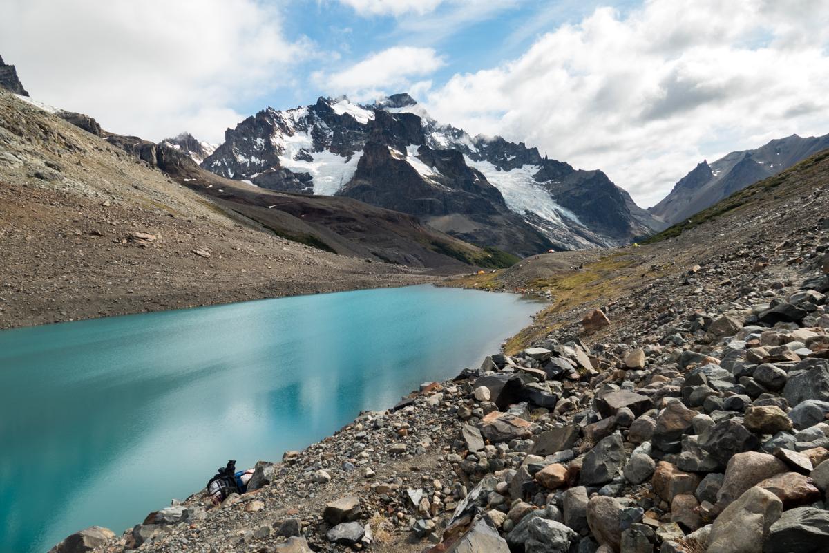
Fitz Roy Loop 
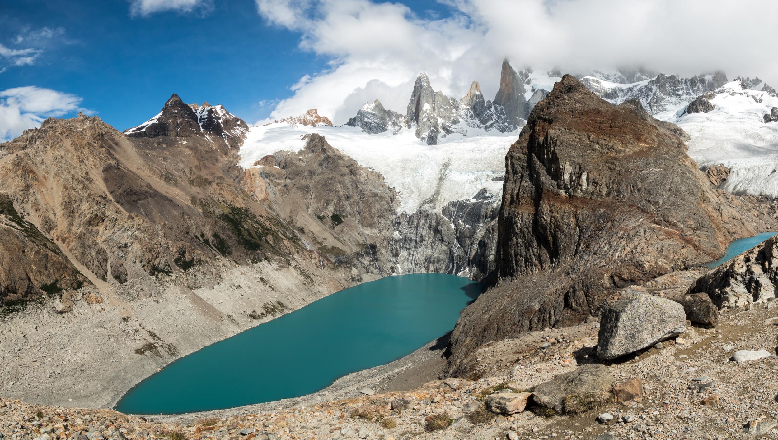
For the Fitz Roy Loop, there are various options to combine different days. If I look at the map now, I think we could have done a more scenic route (there was much forest), but at the same time we also did not always have the best weather frames - both Fitz Roy and Cerro Torre were hidden in clouds when we were at their respective viewpoints. Also, the trail is swamped with other hikers and even day hikers, which took some of the wilderness away from this extremely beautiful place.
For the Fitz Roy Loop, there are various options to combine different days. If I look at the map now, I think we could have done a more scenic route (there was much forest), but at the same time we also did not always have the best weather frames - both Fitz Roy and Cerro Torre were hidden in clouds when we were at their respective viewpoints. Also, the trail is swamped with other hikers and even day hikers, which took some of the wilderness away from this extremely beautiful place.
2017
La Ciudad Perdida 
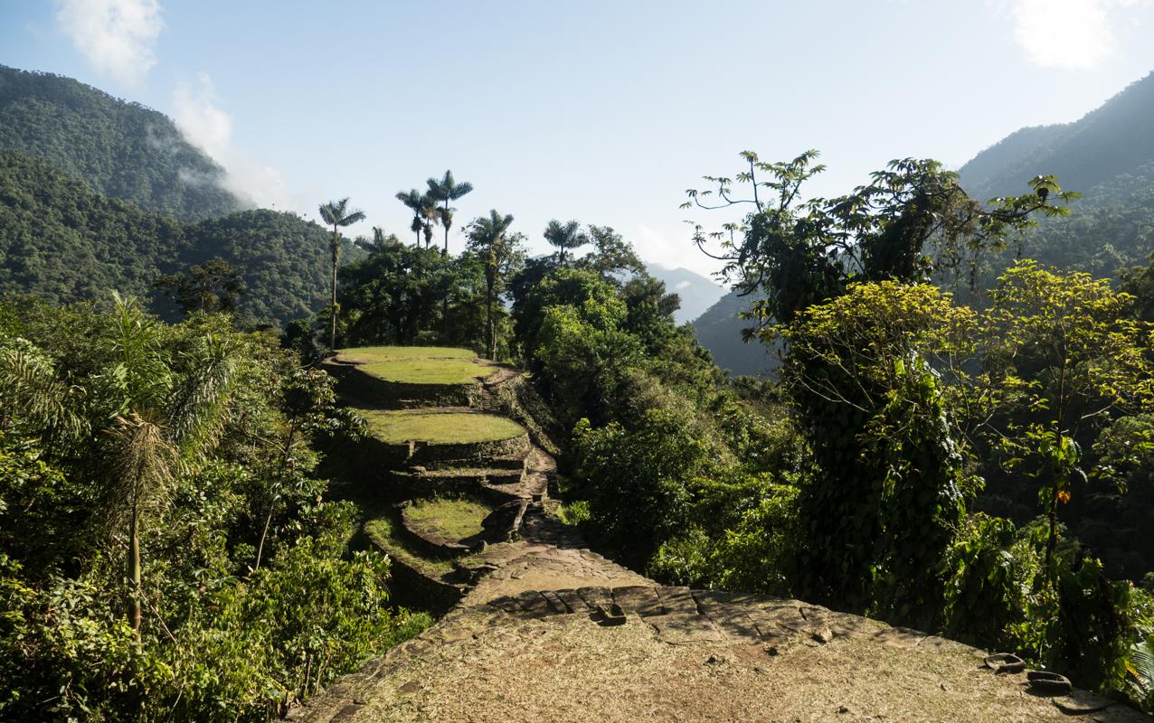
The Lost City trek was an experience with many faces for me. On the one hand, it was very touristy, with some very noisy groups on the trail and fresh beer which does not feel right in a lush jungle, but on the other hand, I was blown away by the splendor of this lost city in the jungle, and the history and culture it breathes. I was very impressed by the terrasses, the vastness of the location, maybe even more so than when I visited Macchu Picchu two years earlier (although this might also be recency bias ;-)). On the first day, it was incredibly hot (up to 40 degrees Celsius), and on the third day it rained heavily, so prepare for all circumstances!
The Lost City trek was an experience with many faces for me. On the one hand, it was very touristy, with some very noisy groups on the trail and fresh beer which does not feel right in a lush jungle, but on the other hand, I was blown away by the splendor of this lost city in the jungle, and the history and culture it breathes. I was very impressed by the terrasses, the vastness of the location, maybe even more so than when I visited Macchu Picchu two years earlier (although this might also be recency bias ;-)). On the first day, it was incredibly hot (up to 40 degrees Celsius), and on the third day it rained heavily, so prepare for all circumstances!
2016
Rwenzori (short) 
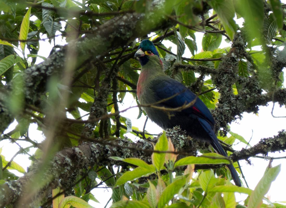
When planning a trip to Uganda, I cannot recommend this trail enough. It was a unique experience, with beautiful endemic wildlife (such as the beautiful Rwenzori Turaco, various sunbirds and the Rwenzori Duiker) and fauna that I have never encountered on any other trek to date. The hike was not very strenuous, even though due to circumstances you can walk a full day over a couple of kilometers. Take proper rain gear!
When planning a trip to Uganda, I cannot recommend this trail enough. It was a unique experience, with beautiful endemic wildlife (such as the beautiful Rwenzori Turaco, various sunbirds and the Rwenzori Duiker) and fauna that I have never encountered on any other trek to date. The hike was not very strenuous, even though due to circumstances you can walk a full day over a couple of kilometers. Take proper rain gear!
Berg Lake Trail 
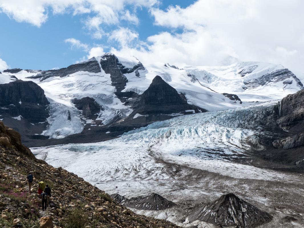
What a magnificent hike. After two weeks of knee issues and cancelled hikes on my trip to Canada, I was told to try my utmost to prepare for this hike, as it was to be the cherry on the cake of this holiday. And boy, did it deliver. Good weather, good knees, and some of the most beautiful sightings that I had seen until then.
What a magnificent hike. After two weeks of knee issues and cancelled hikes on my trip to Canada, I was told to try my utmost to prepare for this hike, as it was to be the cherry on the cake of this holiday. And boy, did it deliver. Good weather, good knees, and some of the most beautiful sightings that I had seen until then.